
Hiking in the French Basque Country is a great way to explore the countryside and discover the incredible scenery of the Atlantic coast and the Pyrenees mountain chain from a birds-eye view. While the area is mostly known for its coastline, beach resorts and surfing spots, few tourists know of all the day-hikes and long-distance routes available outside of Biarritz, Bayonne or San Sebastian,
From the easy coastal paths to the long and challenging trek across the Pyrenees, the Basque Country will have something for you. Here are our top 7 hiking trails in the French Basque Country.


Coastal day hike in the French Basque country
Bidart to Saint-Jean-de-Luz
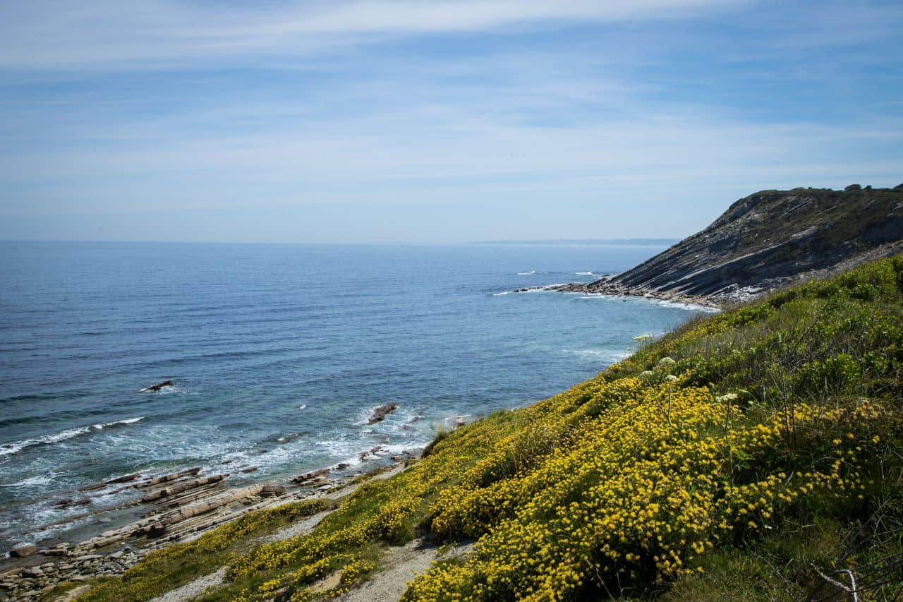
The first part of the Coastal Path between Bidart and Hendaye will offer a large diversity of landscapes along beautiful beaches, isolated creeks and steep cliffs. You will start from Bidart, a small village only a few kilometres south of Biarritz, then cross through Guethary before reaching Saint-Jean-de-Luz in about 3 hours.
It is prefered to leave early during summer to avoid the strong heat of the south of France and if possible at low tides for better views. We loved the last bit of walk-up to the “Pointe de Sainte-Barbe” where the view of the bay of Saint-Jean-de-Luz is probably the best you will have the chance to see.
Time: 3h | Length: 13km | Elevation: 350 m | Difficulty: Medium | Route colour: yellow line | Map colour: yellow
How to get to Bidart:
Bus 13 from Biarritz (Les Halles – Indoor food market) or line C from Biarritz train station and Bayonne – €1-2
Leave from Saint-Jean-de-Luz: Bus 816 to Bidart, Bayonne, Biarritz and Hendaye.
Alternative route
It is also possible to walk the reverse route from South to North.
RELATED │ WHAT TO DO IN BIARRITZ
Saint-Jean-de-Luz to Hendaye
This is the second part of the “Coastal Path” between Bidart and Hendaye. The hike will take you along a beautiful “Corniche” (cliff walk) with great views over Cibourne, then across the protected area of Addabia and its gorgeous castle before reaching Hendaye and the scenic Txingudi Bay. The walk isn’t really hard but it mainly follows a busy road which might be a bit noisy. Thankfully, once at the Addabia natural reserve, you’ll enjoy shade and silence.
Not exactly on the path but only a small detour off the way, is the fortress of Socoa. We can only recommend visiting and enjoying the views of the coast as well as local fishermen and colourful boats anchored at the pier.
Time: 3h | Length: 12km | +300 m | Difficulty: Medium | Route colour: yellow line Map colour: orange
How to get to Saint-jean-de-Luz
Bus 816 from Biarritz, Bayonne or Hendaye.
Leave from Hendaye: Bus 816 North towards Bayonne and Biarritz, or ALSA buses to San Sebastian and Bilbao in Spain. HegoBus also runs daily buses to small villages in France and Span.
Continue Walking
It is then possible to cross the border over to Hondarribia and pursue the coastal walk in Spain all the way to San Sebastian or Bilbao. You can also join the “Northern Camino” or “Camino Frances” via Irun or Pasaia de San Juan.
RELATED │ The most beautiful villages in the French Basque country


Mountain day hike in the French Basque country
Saint-Jean-Pied-de-Port to Roncesvalles
One of the most beautiful hikes in the Basque country, offering incredible panoramas over the Pyrenees. It is the first step of the Camino Frances linking Saint-Jean-Pied-de-Port to Santiago de Compostela in Spain, 800km away. This hike is known to be the hardest part of the “The Way of St. James ” but every effort is rewarded by the views.
It is best to walk from May to September in order to take the Napoleon route that is usually closed during winter. Be aware, however, that the weather can change drastically in the Pyrenees. It is important to follow the path and bring warm and dry clothes.
Once in Roncesvalles, you can get back to Saint-Jean-Pied-de-Port with a local bus or stay the night and continue to Pamplona for another 2-day hike.
Time: 6-8h | Length: 25km | +1520 m | Difficulty: Challenging | Route colour: yellow scallop on blue background | Map colour: Blue
How to get to Saint-Jean-Pied-de-Port
Train from Bayonne (4/day – from €8) – Bus ALSA from Pampelune (1 to 4 buses/day depending on the season) – €22
Leave from Roncevalles: ALSA bus at 3:30 pm & 6:30 to Saint-Jean-Pied-de-Port- €5
Alternative route
If the “Napoleon route” is closed, you can walk via Azoleta (mostly along the national road). The views aren’t as breathtaking and the Camino experience is not as fulfilling. If you are just planning on a one-day hike, make sure it is along the Napoleon route and that the weather is good. It is very challenging but worth it every step of the way! In any case, always be prepared to face any type of weather during the Pyrenees crossing and make sure to check the latest information about the way from the local authorities (check at the tourism office or local police station).
Read More│ What to do in Saint-Jean-Pied-de-Port, a complete guide


La Rhune mountain
The mountain Larrun (“La Rhune” in French) is mythic and is a must-to-visit while touring the Basque Country. It became famous after the Empress Eugénie – wife of Napoleon III – walked to its summit, and ultimately popularising outdoor activities in France during the 18th-century.
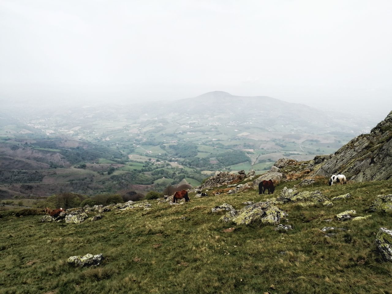
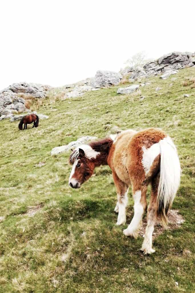
The mountain has a strong past built on Basque mythologies, witch stories and battles between French and English troops. Nowadays, it is a touristic place recognised for its amazing 360° panorama over both Spanish and French valleys, its several Celtic sacred ruins and the local semi-wild poney called “Pottok” roaming the Pyrenean pasture.
Time: 4-5h | Length: 15km | Elevation: 978 m | Difficulty: Medium | Route colour: White-Red / Red-White (GR10) | Map colour: Green
How to get to La Rhune
by car drive towards Sare – HegoBus 21 from Saint-Jean-de-Luz to Sare – Stop at Col d’Ignace
Alternative route
You can start the hike from Sare, the Col d’Ignace or Olhetta. La Rhune’s summit is also accessible by a small train. If you don’t want to hike back down, you can hop on for €16.
Hike La Rhune with a tour to learn about its History and visit Sare and the prehistorical caves.
MORE│OUR 10-DAY ROAD TRIP ITINERARY around THE PAYS BASQUE
Mont Baigura
The Month Baigura is a really nice 3 to 4-hour walk you can turn into a day trip by bringing a picnic with you. It is an easy trail with some steepness at times but nothing too technical. There are two ways to get to the summit. Either you are super fit and will take the steep “expert trail” or will take your time along the “Sentier de découverte” (informative walk).
We would recommend the latter which will take you around the mountain from where you will have an incredible view over the distant snowy peaks of the Pyrenes. What we like the most about this hike is the large wildlife encountered along the way: Pottoks, buzzards, vultures and falcons, among others.
Mount Baigura is very popular with paragliders. You can organise a flight directly to the leisure park right across from the start of the hike.
Time: 3-4h | Length: 8.7 km | +620 m | Difficulty: Medium | Route colour: yellow line | Map colour: Purple
How to get to the start of the Mt Baigura hike
You will need your own car. Direction Louhossoa where you will need to drive a further 3 km to the Louhossoa’s leisure park (Follow the road sign: “base de Loisirs“) – 20 min drive from Saint-Jean-Pied-de-Port or 50 min from Biarritz/Bayonne. You can also take a train from Bayonne to Louhossa (€6) and walk/hitch-hike to the start of the hike.
MORE│7 places to not miss in the Spanish BASQUE country

Long-distance hikes in the French Basque Country
GR10 – From Hendaye to Banyuls (45+ days)
The GR10 is one the longest and hardest walks (“grande randonée”) in France. It links the Mediterranean sea to the Atlantic Ocean – and vice-versa – along the Pyrenees via the most beautiful National Parks of the mountain chain. The trek is quite challenging and can only be completed in summer when the peaks aren’t closed because of the snow. Not many people walk the entire length in one go because of the time required and the challenging conditions.
If you are interested in hiking for a week or so, in the mountain while visiting the Basque Country, you can join the GR10 for 4 to 7 days from Hendaye to Saint-Jean-Pied-de-Port or from Saint-Jean-Pied-de-Port to La Pierre Saint Martin. These are two incredible hikes but they require a good physical condition and hiking experience.
Time: up to 60 days | Length: 870 km | Difficulty: Challenging | Route colour: Red-White | Map colour: Brown

THE FRENCH WAY – From Saint-Jean-Pied-de-Port (32+ days)
The Camino de Santiago (also known as The Way of St-James) is a pilgrimage path that is walked each year by more than 300,000 people, either in full or in small sections.
At its origin, during the Middle-Ages, the Camino was one of the 3 most important Christian pilgrimage paths along with the routes to Jerusalem or Rome. It has been walked for centuries through a large network of Roman and ancient merchant roads across Europe, all directing towards Santiago de Compostella in Galicia, Spain, where the remains of the apostle Saint James the Elder are believed to rest. Even if, nowadays, not all walkers undertake the Way for religious reasons, many find in the journey a spiritual purpose which ultimately turns a walker into a Pilgrim and a walking holiday into a pilgrimage.
In our modern world, the most popular route, called “The French way”, leaves Saint-Jean-Pied-de-Port in France, at the feet of the Pyrenees. In average, pilgrims will complete the 790km walk to Santiago de Compostella in about 35 days, crossing along the way the Pyrenees Mountain, and the regions of Navarra, Basque Country, Castilla y Leon, and Galicia.
The walk is fairly straightforward and not as technical as the GR 10, but the length can impact the pilgrim’s body and feet. it is therefore recommended to prepare yourself long in advance.
Time: 7 days | Length: 790 km | Difficulty: Moderate | Route colour: Red-White or Yellow scallop shell on blue background | Map colour: Blue
Related | What to do and see in Saint-Jean-Pied-de-Port

MAP OF THE BEST HIKES IN THE FRENCH BASQUE COUNTRY
WHAT TO PACK TO GO HIKING FOR THE DAY?
The day hikes in the French Basque country aren’t very technical so you won’t need to bring hiking poles or sophisticated hiking gear. However, it is important you wear a good pair of shoes to walk on gravelled paths along erratic cliffs and potential hazardous mountains.
If you plan on hiking during summertime, bring a hat to protect your head from the sun, wear sunglasses and apply enough sun cream. We also like to use a Buff as either a scarf when it gets cold or a headband covering the ears in case of strong wind. If you have sensitive ears to cold wind like Jenny, it is a lifesaver!!
We would also recommend carrying 2 L of water per person. Most hikes don’t have fresh water sources where you can refill your bottles, so it is best to carry enough from the start. A good product to invest in would be a water bladder. They are easy to adjust to any backpacks.
The weather in this part of France can differ, and days without rain are as rare as if you were in Ireland! So make sure to bring a rain jacket as well as a dry bag to protect your electronics such as your phone or camera. If you go to high altitude or plan on a crossing pass in the Pyrenees, always pack all-season clothes, even in winter. Along the French Way to Roncesvalles, it isn’t rare for Pilgrims to end up caught in dense fog, strong wind and even snowfalls any time of the year. Pack a down jacket for its lightweight and high capacity to keep you warm, a windbreaker and a change of socks.
If you go for a short hike but want to turn it into a day out, bring a picnic with you!
ARE YOU ON PINTEREST?
What about saving this post to your Pinterest board? Click on the photo to save this blog post for later.
We are also on the platform and we love pinning great travel tips. Follow Tales From The Lens’ boards to see our latest pins.
Don’t be shy, come say hi!
Please note │ This blog post may also include affiliate links to hostels or products we recommend, which means if you buy something following a link on this page, we’ll get a small commission. This will be of no extra cost to you but will help us continue running this blog. Thank you for your support.

About the Author
Jen is the Funder, Author & Photographer behind Talesfromthelens.comJen has lived for the past 15 years across Oceania and Ireland while also travelling in Latin America, North America, and Europe. She has visited more than 65 countries and set foot on every continent in the world! She is a coffee nerd, passionate about photography, wildlife, and outdoor activities.
For more info, check out the About page.