
If there is something on every Bolivian backpacker’s list, it is hiking in Sucre. The Maragua crater, located near this beautiful Bolivian town, offers one of the best treks to see the Sucre countryside. While you can join a hiking tour with an agency, many of the hostels’ conversations in town are about how to hike Maragua Crater without a guide.
After some unsuccessful research online and contradictory tips, we decided to give it a go anyway, and ultimately we learned the hard way. We made some mistakes, we got lost, but we made it, and it’s a hell of a great hike!
Here is our self-guided itinerary for a successful 2-day Maragua Crater trek without a guide.
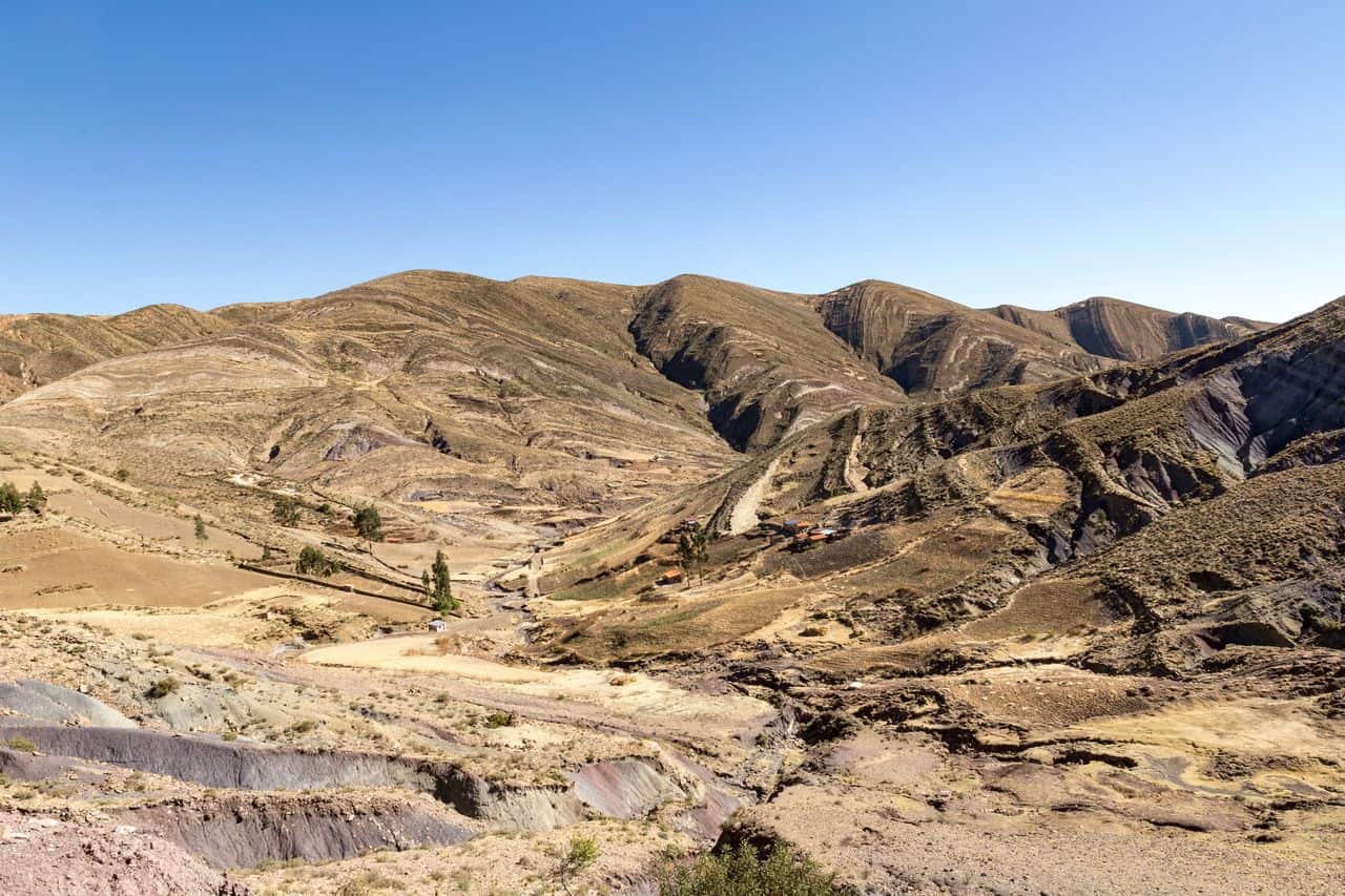
Markings of the Maragua crater hike
The Maragua Crater hike has a little reputation in Sucre, but people hardly talk about it outside the town. This is an exceptional hike, though, but most people do not dare start the adventure because they lack information about what to expect.
Word of mouth has revealed how hard it is to find the trails in some parts. Since you are reading this blog post, it is probably because you are looking for information to help you prepare. Well, you are in the right place!
First, we recommend you download an offline Map app that allows you to see trails. If you are looking for something free, Maps.me is a must-have on your phone while travelling in South America. You download the area you are in, and you will find trustworthy information about hotels and restaurants, as well as lots of hiking trails. This app is perfect for backpackers, and we have always found it very reliable when trekking.
However, the main issue with maps.me is that you cannot check if the trail still exists, nor the topography or its quality. Often, the trails are, in fact, shortcuts made by locals that can turn out to be quite dangerous and misleading. The trails on the Maragua map aren’t an exception.
The itinerary below results from our experience hiking Maragua Crater. We got lost, turned around a few times, and built this detailed guide as soon as we came back.
We also considered what other trekkers we met told us about their experiences and our amazing readers who commented on this article to give us some updates!
Readers feedbacks:
– Some watch apps (like Garmin) have this trail mapped entirely.
– Part of the hike is also available on the AllTrails app, but you need to be a paid user to access the AllTrails download for offline use.
Sucre to the Maragua Crater – Day 1
How to get to the start of the trek
The Maragua crater is a hike from a gravel road near the “Virgen de Chataquilla.” To get there, you will need to take a bus that passes by the start of the hike (which is really in the middle of nowhere).
Based on one of our readers’ comments, as of April 2024, truffies leave Plazuela San Junillo at 5 a.m. (once it is full). Otherwise, you can also go to the Parade Ravelo (also known as Parada Por Potolo). If you ask your taxi driver, they will bring you to the right place, Though be early!
If you miss it, you can hop on a truck, but the price is generally much higher. Hitch-hiking might be quite hard, as the road is not used much. We have seen people getting a taxi, but that’s not really budget-friendly for us.
After driving on the paved roads out of Sucre, we turned left and climbed a windy gravel road. The bus dropped all the hikers at the “Virgen de Chataquilla” statue, where we found the starting point of the trek and our first Inca Trail.
Tips: Once at the Virgen de la Chataquilla, look for steps on the left of the road. They can be tricky to find, so use your GPS. You should also spot a couple of arrows on the rocks.
The Inca Steps
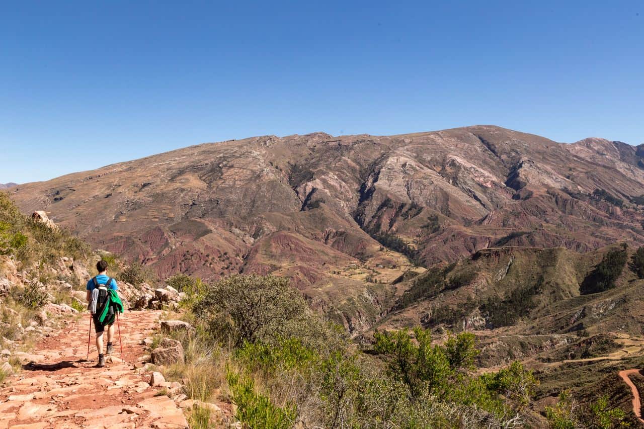
The steps led us down for about one hour towards Chaunaca, offering incredible views of the entire valley. For the first time, we witnessed the dry landscape of Sucre’s countryside and its beautiful palette of multiple shades of red, yellow, and green.
It is a unique and untouched landscape with sparse vegetation and an enjoyable lack of human presence.
Chaunaca, road tolls and map issues
Once in Chaunaca, we paid the “toll” to the community (10 Bs). The toll is just one person from the community sitting in a hut charging the hikers before letting them continue their trek. In most of Bolivia, there are tolls like this to access countryside roads. Locals set them as a revenue stream to support their community.
There should be only one toll along the way, but we passed a couple more later that day. In fairness, it is a very small amount of money to pay that helps the entire village and community survive and build infrastructure. It’s not that big of a deal, so there is no need to get offended or try to avoid the toll. Pitching in might help make a difference in this part of the world.

After the toll, we went down to the village on the left. Here, we thought we were lost more than once, as no defined or marked trail exists. The truth is, there are a few ways to walk around.
The options are 1) a road, 2) trails, and many other shortcuts made by locals. It’s quite confusing. Add to this multiple paths to reach the village of Maragua and a GPS that shows only half of the trail! It’s not a great start, but here is the information to avoid getting lost.
From Chaunaca, there are indeed two trails: one that follows the main gravel road used by cars and one that goes through the forest along the river. The correct trail is the one on the left along the river, but it is also partially mapped on our GPS map. We, therefore, decided to cross the bridge to the right and follow the road to Maragua instead.
Two trails to Maragua: which one is right?
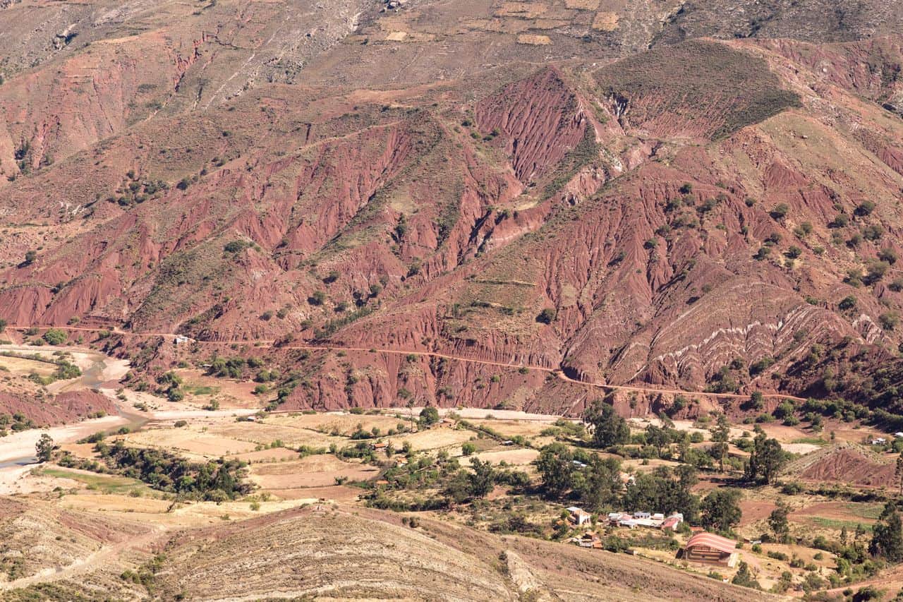
The gravel road
This road crosses a couple of farms and one or two tolls (people in huts). It also takes a little less time and effort to walk. It took us 5 hours instead of the 7.5 hours other hikers initially told us. The hike is also more leisurely as the climb is constant. The view over the valley is breathtaking, and you have more chances to meet locals or see them working in their fields.
The river-bed trail
Contrary to the road, this path is mainly flat until the end, when it requires hiking up a very steep section to the Maragua waterfall, known as La Garganta del Diablo. At this altitude, it can be quite exhausting.
From what we heard from other travellers, the river bed trail is not easy to find because of the lack of info on maps.me and the non-existent trail markings. Hikers can end up following a path that leads nowhere, forcing them to turn around and try another route (maybe that is why some hikers took 7.5 hours?).
On the other hand, this trail takes you into the forest, into a very remote place with no human activity. You will likely not have to pay any tolls on this trail.
Altitude sickness during the hike:
As we first started climbing up a very gentle incline, we all started getting headaches and feeling dizzy. This is what altitude sickness does to you!
However, the mild symptoms that hit us were quickly taken care of by drinking lots of water, taking deep breaths in and out, and chewing Coca Leaf, the traditional Bolivian cure for altitude sickness.
Altitude sickness can be life-threatening and shouldn’t be taken lightly. If the symptoms get strong, such as vomiting, fever, or unconsciousness, the only remedy is to return to a lower altitude as soon as possible and seek urgent medical support.
Maragua village

Maragua is a tiny village within the Maragua Crater with a church, a school, and a couple of “tiendas” (shops) where you can buy beer, coke, and toilet paper. The families live in adobe houses, but they also dry the corn they cultivate right in the middle of the town.
There are only 2 basic places to spend the night, and they are not advertised. We knew the names and asked the locals who didn’t seem to know or understand. The local farmers sent us all around the village looking for them.
One of the hostals (guesthouse) is “Don Basillo” (also called Rumi Wasi), which is located on the main road, right across from the school. We arrived quite early, so we had the chance to get a bed, but a large group arrived after nightfall and slept in the corridor on the floor. They absolutely wanted to stay here and, for some reason, not try to go to the other hostal, “Samary Wasi,” where there was space.
The 2 hostals offer the same service: a bed, with dinner and breakfast included in the night’s price. Don’t expect showers here as the water supply is quite limited. However, since this big group arrived late, just as the owner began to make dinner for 5 people, our dinner portion of rice, potato and egg was split between everyone. Saying we had a very small plate would be an understatement.
Make sure to bring extra snacks with you.
The next day, our host didn’t seem enthusiastic about cooking breakfast for 16 people. He, therefore, went to buy crackers for everyone. We would have probably had a better experience, and more food, at the other hostal which was less crowded.
When the tours bring groups into Maragua, they usually take them to the village craft store to look at locally made art and weavings. When we arrived, the store was closed, and we left too early in the morning to check it
Maragua to Potolo – Day 2
Leaving Maragua onwards

The next morning, we started early to ensure we would reach the village of Potolo by lunchtime. The trail is initially quite easy, following a well-defined route on Maps.me. You can follow the road as it winds up the hill, but locals have made a more direct route straight up, which is much quicker but more tiring.
The route gets complicated when going through farms because, despite being clear on the map, the trail isn’t visible in reality.
We found ourselves walking through cornfields and across private land as we missed a turn or lost the path. All in all, it was fine. According to the GPS, we knew we had to go straight or to the right, but it required a bit of searching.
It’s probably why people prefer hiking with a guide. We can understand that. It would have been easier, but hiking Maragua Crater on your own is not that hard. It just takes a bit of time and requires using a GPS.
The Dinosaur footprints

We chose the trail going to “Huellas de dinosaurios Miñu Mayu,” a small place where dinosaur footprints can be found. Even though we had been to the “Cal Orck’o” park outside of Sucre to see Thousands of dinosaur footprints, we thought it would be nice to see more, closer, and right in the middle of nowhere. We stopped and sat next to the footprints for a well-deserved break and snack.
We had been told we might have to pay a fee to see the footprints (about 20 Bs), but nobody asked us anything. There was a house next to the footprints and people working in a near by field, but no one seemed bothered by us.
Crossing Chulpa and arriving in Potolo
After the dinosaur footprints, we once again lost the trail through the cornfields but quickly found the dusty road that was going to lead us to Potolo.
From there it is a straightforward walk with incredible views. The dusty road crosses small farms, villages and eroded canyons. We used all the shortcuts made by the locals which made the walk fast and more entertaining. The Bolivians sure love shortcuts!
We arrived in town as children were leaving school and walking home, back along the paths we had just hiked. We couldn’t imagine how far they had to walk as the only houses we saw outside of Potolo were kilometres away.
Once in Potolo, we waited at the main square for the bus heading back to Sucre. We grabbed some water and a beer from the local stall and were immediately picked up by the bus.
> At the mains square in Potolo, trufis leave more or less at 2 pm and 5 pm.
Now, let’s put it this way, we have taken more than 130 buses in South America, from the good to pretty awful. So trust us when we say this ride was the scariest we had encountered. A narrow, windy, gravel road up to the side of the mountain with a drop of hundreds of metres, and the noisiest and
But…this was a surreal experience. Surrounded by local farmers on their way into town, the bus was filled with chickens, goats and even sheep in the storage area under the bus. Every now and then we would hear the sheep calling out.

Self-guided Maragua crater trek vs tour agency
We hope not to discourage anyone with our description of the tolls and scary bus ride. It probably sounds worse than it is!
The Maragua Crater hike is a hit. It is a must-do while staying in Sucre for more than a couple of days. This is the type of hike that does not happen often in South America.
If you still wish to hike the Maragua crater with a guide, you can join Pablo from Greentrekkers. He organised hikes in Sucre and was highly recommended by readers of this website.
Alternatively, you can take this 1-day trip to Maragua Crater via the Inca Steps.
Note: We only knew of Condor Trekker, which unfortunately seems to have closed down. If you have any recommendations, please let us know in the comments!
We need you!
Have you done this hike or about to do it? Tell us about your experience in the below comment section or via email! Hikes like this are pretty rare in South America, and we want to share the most accurate information with our readers.
Since we have completed this hike back in 2017, there doesn’t seem to be much more information online about the Maragua Crater, so we hope our guide is still somehow useful.
We have received many emails over the years and updated our content accordingly. If you have any extra information (hostal, bus, tolls, route), please let us know and we will share them.

ARE YOU ON PINTEREST?
What about saving this post to your Pinterest board? Click on the photo to save this blog post for later.
We are also on the platform and we love pinning great travel tips. Follow Tales From The Lens’ boards to see our latest pins.
Don’t be shy, come say hi!
Please note │ This blog post may also include affiliate links to hostels or products we recommend, which means if you buy something following a link on this page, we’ll get a small commission. This will be of no extra cost to you but will help us continue running this blog. Thank you for your support.

About the Author
Jen is the Funder, Author & Photographer behind Talesfromthelens.comJen has lived for the past 15 years across Oceania and Ireland while also travelling in Latin America, North America, and Europe. She has visited more than 65 countries and set foot on every continent in the world! She is a coffee nerd, passionate about photography, wildlife, and outdoor activities.
For more info, check out the About page.
Thanks for all the information! I’m thinking of doing this hike solo this weekend. When you say the bus from Potolo to Sucre is around lunchtime, what time is that? I’ve read the hike from Maragua to Potolo is 5 hours, and it would not be good to miss the bus.
Hi Steph, we took the 2 pm bus. Hopefully, it hasn’t changed since, but we heard that there are a few buses per day from Potolo to Sucre.
Now, Bolivia being Bolivia, timetables are inexistent and things can change from one day to another. I am sure the 2 pm bus will still be running, but if you are worried about it, maybe you could confirm with people from your hostel. We met many backpackers who did the hike before us and you might as well find a few people who will confirm the time to you once there.
Let us know!
Hey thanks for all the info! Got a question:
What time recommend to start second day?
Thanks
Hi Daniel, happy to help!
It is best to get up with the sun, get ready, and go. 8 am is a good time to leave Maragua if you plan to take the bus in Potolo at 2pm. We would recommend anyway to check with the owner of the hostal what time breakfast is served, they will know what’s best depending on the season. Hope you’ll enjoy your hike!
Thanks for the info, did this hike the past two days and I think it might help to share the following info. For those who are interested, their are at least two hostels in Chaunaca. We met some people that split their hike over three days. One of the locations is Samana Wasi, can be found on google maps. Also the missing parts of the hike on maps.me can be found on google maps as well. Many buses leave daily from Potolo, we caught one at 5pm, and that was not the last I think. Also the road has improved, it was possible to pass other cars at any moment and we did not feel unsafe anywhere although it had rained the day before. The road condition and more frequent buses go hand in hand I guess.
Thank you so much for this amazing update! I’ll make sure to add these to the article. I hope you enjoyed Maragua Crater and Bolivia.
We wrote this guide in 2017 when there was no information online about Maragua, so seeing that years later it is still used by fellow travelers makes me happy. I really appreciate you for taking the time to share your experiences with me and my readers to ensure we can provide more accurate information to others. Thanks a lot!
Thanks for the extra info. Did the bus from Sucre to Chataquila still leave @ ~9:30am. There is now a pinned location on maps me that suggests 6am.
Hi Jared, I am afraid that I wouldn’t know if the time has changed or if there is an earlier bus now. If you ever find out when in Sucre, let me know and I can update the article.
Hi Jen, thank you so much for this great report – it helped me so much in doing this hike by myself! I actually did it in one day, so this is also doable but it will be quite a long hike.
About the trufis:
-At Plaza San Juanillo in Sucre, the first one is leaving at 5am. We departed at about 6:15am once it was full.
-At the mains square in Potolo there is a trufi leaving at 2pm and 5pm (más o menos)
Wow Konstantin! Well done on doing the hike in a day! And huge thank you for sharing some update on the trufis. I Will update the article so it can help future hikers.
Because of unpredictably weather during our stay in Sucre, we decided to take this tour with a guide. We looked for the condor trekkers office, but couldn’t find it. We ended up with Pablo from greentrekkers and we had a superb experience during our two day hike. If you’re looking for a guide, it’s definitely a good choice to go over there. It’s located right next to the mercado central, you can find it on google.
Thank you Jolien, shame that Condor Trekker has closed down but thank you so much for sharing an great alternative tour you found. I will update the article with your recommendation so our fellow backpackers can join if they wish to!