
The South of France, renowned for its diverse landscapes, rich history and culture, is also a paradise for hiking enthusiasts. From the azure waters of the Mediterranean to the majestic peaks of the Pyrenees, the region offers a plethora of trails that cater to all levels of experience.
In this article, we have listed more than 20 best hikes in the South of France. And when we say South of France, we mean from the Atlantic Ocean to the Cote D’Azur, not just the French Riviera! So if you are visiting lesser-popular areas, like the French Basque country or Occitanie, we also got you covered!
Gorges de Galamus – Pyrenees-Orientales

The Gorges de Galamus is a little gem that not many know about. Located 1 hour from the town of Perpignan in the Pyrenees-Orientales, this spectacular protected natural site was carved by the river Agly meandering through vertiginous limestone cliffs. It is a place highly appreciated for canyoning and hiking but also for its hidden away Hermitage of St Anthony of Galamus built on the cliffside.
The road that winds through the Gorges de Galamus is notoriously narrow, fitting only one car at a time in many places. However, the true essence of the gorges is best experienced on foot. It is recommended to leave your car at the first parking and walk along a shaded trail for 10 minutes to the Hermitage of St Anthony of Galamus. From there, you can continue the walk through a short dark tunnel, climb up a series of steps, and follow the narrow road for about 1.5km (1 mile).
For those looking for long hikes in the area, the surrounding French Catalan backcountry offers additional routes. Notably, the 4km (2.5 miles) one-way trail from Saint-Paul-de-Fenouillet to the Gorges de Galamus starts in the town’s center and leads to the main car park, providing a scenic route that eventually joins the path called “La Campariere” before reaching the gorges.
For a more challenging hike, the Gorges de Galamus Loop Hike spans 9km (5.5 miles), starting and ending at the first Car Park, with a total elevation gain of 470m (1.500 feet). This trail is marked with yellow signs and offers stunning views of the Agly Valley. It requires approximately 4 hours to complete.
Read our dedicated article: How to visit the Gorges de Galamus
The Cathar Trail – Corbières
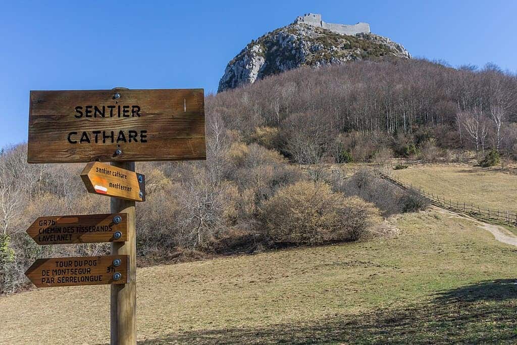
The Cathar Trail, known in French as the Sentier Cathare, will take you through the scenic landscapes of the Corbieres while tracing the footsteps of the medieval Cathars. In fact, this long-distance trail, stretching over 250 km (about 155 miles), winds its way from the Mediterranean coast near Port-la-Nouvelle to the historic fortress of Foix, nestled in the heart of the Ariège region.
The trail is marked by yellow signs featuring the Occitan cross and can take about 12 days to complete. Although, it can be divided into manageable sections, allowing for day hikes. The difficulty level varies, with some parts offering easy walks and others presenting challenging climbs and descents, suitable for more experienced hikers.
Walking the Sentire Cathare will take you from vineyards to the rugged terrain of the Corbières and Fenouillèdes regions. though, one of the highlights is the several Cathar castles, such as Peyrepertuse, Quéribusa and Puilaurens that you can visit on the way. The trail also goes through picturesque towns of the south of France, providing opportunities to explore the region’s history and taste the local cuisine.
The best times to hike the Cathar Trail are spring and autumn when the weather is mild. In terms of accommodations, options range from camping and gîtes (holiday homes) to bed and breakfasts but will require booking ahead.
Check out our article about the Cathar Castles in Southern France
Nietzsche Trail in Eze – Provence-Alpes-Côte d’Azur

For those looking to enjoy incredible views of the French Riviera coastline while embarking on a fun hike near Nice, consider doing the Nietzsche trail! This 5km (3.1-mile) out-and-back trail wraps around a mountainside that leads up to the ever-charming, medieval village of Èze.
On average, the day hike takes about an hour to complete in one direction. That said, don’t let the relatively short amount of time you’ll spend on the trail fool you. This trail is fairly challenging and not for the faint of heart. It can be quite slippery with all the loose dirt, rocks, and uneven stairs.
Although, the panoramic views of the surrounding region make it worth all the effort! So while it’s not family-friendly, it is dog-friendly. Just make sure they are well-behaved as this trail is fairly popular, and you’ll likely encounter other hikers.
To access the hike, you can take the train from Nice to Eze-sur-Mer and walk about 10 minutes to the trailhead. Be sure to wear proper hiking attire and bring ample water as you’ll work up a sweat!
Sentier Martel – Gorges du Verdon

One of the most famous hikes in Southern France is the Blanc-Martel Trail (Sentier Blanc-Martel) in Gorges du Verdon. The trail is part of the bigger GR4 route (Grande Randonnée 4) that crosses France from the Mediterranean to the Atlantic.
Although you can walk the trail in both directions, it is recommended to start at Chalet de La Maline and finish at Point Sublime. The hike takes you to the bottom of the Grand Canyon of Verdon and along the Verdon River rewarding you with breathtaking views of the scenic surroundings.
There’s a shuttle service in the morning from La Palud-sur-Verdon to Chalet de la Maline and in the afternoon from Point Sublime to La Palud. There’s also a good bus connection from Castellane and Moustiers-Sainte-Marie to La Palud for those who want to hike the trail. The shuttle operates only from the beginning of April until the beginning of November.
Hiking the Blanc-Martel Trail takes about 6-7 hours (16 km – 10 miles) and requires a whole day. The hike is not easy, so if you are not fit or if you have vertigo, you should not venture on it. It also involves descending stairs.
The trail is not suitable for children aged 8 and under and dogs are not allowed on the trail. Make sure you wear solid hiking shoes and carry a torch, as you will be passing through tunnels, and have at least 2 litres of water with you as well as food for the day.
Vallée des Merveilles – Mercantour National Park

The Vallée des Merveilles, nestled within the Mercantour National Park, is a place where nature and ancient history intertwine, offering hikers a unique journey through one of France’s most enigmatic landscapes.
This remote valley is home to over 40,000 Bronze Age rock carvings, making it one of the largest open-air collections of petroglyphs in Europe. The carvings, which depict figures such as weapons, animals, and mysterious symbols, provide a fascinating glimpse into the lives and beliefs of the valley’s pre-historic inhabitants.
There are several trails of varying difficulties that lead to and through the Vallée des Merveilles, catering to both seasoned hikers and those looking for a less strenuous experience. The most common routes start from the Fontanalba Valley or the Merveilles Valley itself, with hikes ranging from day trips to longer excursions that can take several days, depending on the chosen path and pace.
However, to protect the fragile environment and the integrity of the rock carvings, access to certain parts of the Vallée des Merveilles is regulated. Guided tours such as this one from Nice, are available and recommended.
The best time to visit is during the summer months, from late June to early September, when the snow has melted, and the weather is most favorable for hiking.
Chemin de la Mature – French Pyrenees

In the Pyrenees, there are endless trails to explore but few are as unique as the Chemin de la Mature. This amazing hike takes you along a 4,000-foot-long “path” carved into a sheer rock face.
Rated class 3 out of 6 for exposure, the Chemin is more than a trail, it’s an exhilarating journey whose beauty is topped off with breathtaking views of mountains and valleys along the way. The exposure could seem intimidating to those fearful of heights but don’t worry, the ledge isn’t that narrow. It comfortably accommodates 2-3 hikers side by side.
The Chemin is best enjoyed by completing a full 11 km (7-mile) clockwise loop beginning from the town of Etsaut, which is only 15 minutes from the Spanish border directly south of Oloron-Sainte-Marie.
As a bonus, on your descent, you’ll pass by the ancient fortress of Fort du Portalet which is quite an amazing sight that feels like you are travelling back to medieval times.
Public transportation is not as abundant in this latitude of the Pyrenees so you’ll want your own car to get there, or rent one from Pau, the closest city. With 700 m (2,300 feet) of elevation gain and exciting exposure, the Chemin de la Mature is best suited for intermediate hikers who love mountain views and unique hikes in nature.
Cirque de Gavarnie – French Pyrenees

Cirque de Gavarnie, up in the French Pyrenees in the South West of France, is a UNESCO World Heritage site that offers an unforgettable hiking experience. This natural amphitheatre is a wonder to explore, with its towering cliffs and cascading waterfalls.
The nearby town, Gavarnie, is where you’ll start your journey. To get there you may need a car as public transport from Lourdes remains sporadic. There is a mandatory parking fee of €5 in the village which is also closed to traffic from 9 am to 5 pm, so make sure to arrive outside of these times. Although it’s a great weekend trip from Barcelona, Toulouse or Biarritz, it is an ideal getaway.
The hike itself is family-friendly but dogs are not allowed since it is a protected site. The trail leads from the village along the Gave de Pau River, ending with a stunning view of Europe’s highest waterfall. It’s an easy walk with a short incline by the end, but there are tougher trails for those seeking a challenge such as Roland’s Breach, Pic du Milieu or Mont Perdu.
Pic du Midi d’Ossau – French Pyrenees

The Pic du Midi d’Ossau is a striking landmark in Occitanie, known for its imposing silhouette and challenging ascent. Standing at 2,884 meters (9,400 feet), this solitary peak dominates the landscape.
The ascent to the Pic du Midi d’Ossau is indeed not for the inexperienced. It requires a full day’s commitment, often starting before dawn to make the most of the daylight hours.
The standard route, known as the Voie Normale, involves technical climbing, with sections that require scrambling and the use of hands for balance and progress. The presence of loose rocks and steep gradients adds to the challenge, demanding focus, fitness, and a head for heights from all who attempt it.
However, the rewards of reaching the summit are immense. Panoramic views stretch across the Pyrenees, from verdant valleys to neighbouring peaks. The ascent and descent, while physically demanding, are also a journey through alpine meadows blooming with wildflowers to stark, rocky outcrops where the silence is broken only by the wind.
Of course, preparation is key for those aiming to tackle Pic du Midi d’Ossau. Adequate gear, including helmets, climbing harnesses, and possibly ropes for less experienced climbers, is essential. Many choose to hire local guides.
Calanque d’En Vau – Cassis

The Calanque d’En Vau hike is a spectacular coastal day hike between the towns of Marseille and Cassis. Located in the Calanques National Park, the hike starts at Calanque de Port-Miou, just outside Cassis. The best way to get to the trailhead is by car or by walking from the centre of Cassis.
The hike is 4 km (2.5 miles) one way and leads you along the coast, through beautiful pine forests and rocky landscapes. At the end of the trail, you’ll arrive at the breathtaking Calanque d’En Vau, one of the most beautiful beaches in the south of France, hidden between tall limestone cliffs.
With its picturesque surroundings, neon blue water and chalk-white pebbles, this place is a true natural wonder and a must-visit spot on any South of France itinerary. There, you can go swimming or snorkelling in the crystal clear sea or simply soak up the Mediterranean sun from the pebbled beach.
Despite the secluded location of Calanque d’En Vau, it receives lots of visitors in the summer. Also, be aware that the trail might be closed on some days in the summer months due to the risk of wildfires.
This hike is of moderate difficulty and has a section that requires climbing over large rocks. Therefore, it’s not suitable for small kids or dogs.
Looking for a tour to visit the Calanque near Marseille & Cassis?
Collioure to Cadaquès – Pyrenees-Orientales

Embarking on the hike from Collioure to Cadaquès, adventurers traverse a breathtaking stretch of the Mediterranean coastline, connecting France and Spain. This journey is not just a hike; it’s a cultural immersion, showcasing the rich heritage and stunning landscapes of the region.
Covering a distance of approximately 32 km (20 miles), the trek is often completed in segments over 4 to 5 days.
The trail begins in the picturesque French town of Collioure, known for its vibrant streets and historical landmarks, and concludes in Cadaquès, Spain, a town celebrated for its whitewashed houses and as the summer retreat of the famed artist Salvador Dalí. Between these two points, you will cross a varied landscape of rugged cliffs, secluded coves, and pristine beaches, with the azure blue of the Mediterranean Sea as a constant sight.
The path itself offers a moderate challenge, suitable for hikers with some experience. It winds through vineyards, over coastal headlands, and past ancient ruins.
Sentier du Littoral in Cap Ferrat- French Riviera

The Sentier du Littoral of Cap Ferrat is a coastal pathway that follows the perimeter of the Cap Ferrat peninsula on the French Riviera, just outside of the city of Nice.
This hike is just delightful, as you’ll be walking right along the sea, sometimes next to charming villas, but oftentimes hiking next to craggy coastline and passing pretty beaches.
It’s worth hiking for the amazing sea views, the adorable coastal coves you’ll pass by, and the fact that you can easily escape the crowds here.
You can easily get to the trailhead by taking the train to Beaulieu-sur-Mer and walking the 15 minutes to the start of the hike. The hike is divided up into 3 sections, and you can easily just do one or two of the sections if you prefer. The path also passes through the tiny village of Saint-Jean-Cap-Ferrat as it winds along the peninsula.
The entire hike is 10 km (6 miles), and it’s a very easy hike – most of the pathway is flat and almost all of it is either paved or lined with flat stones. This is a great family-friendly hike, and dogs are welcome but must be kept on a leash.
Gorge de Héric – Haut-Languedoc

The Gorges d’Héric is a wonderful destination located in the Haut-Languedoc Regional Natural Park near the town of Mons-la-Trivalle. The gorge is famous for its dramatic cliffs, lush vegetation, and the crystal-clear waters of the Héric stream and waterfalls that flow right through it.
While offering various hiking paths of varying difficulties, the most popular one is the hike up to the small hamlet of Héric. This trail, suitable for families and also dog-friendly, is a 5 km (3 miles) walk and takes you through the gorge along the river and past small waterfalls along a paved road that can even be covered with strollers.
The trail is approximately 1h30 to 2 hours one way so you’ll need to factor in at least four hours to make it to the hamlet of Héric and back. Because it is a relatively easy path, it is an ideal day hike with stops along the way to bathe and swim in the many rock pools you will encounter on the way.
The Gorge is accessible by car, with parking available, though public transport options are limited. Parking is free in the low season but from mid-April to mid-October a fee of € 3,50 is applicable.
You can bring snacks or lunch along the trail and picnic along the river banks but there’s also a small bar at the top of the hike selling drinks and sandwiches with cheese, ham, or paté.
Contributed by Annelies from Travelers & Dreamers
Sillan-La-Cascade – Provence

Sillans-la-Cascade is a dreamy waterfall located one hour away from the famous Gorges du Verdon, in the south of France. This waterfall is so scenic that the whole town is named after it.
You can visit it during a hike in the forest surrounding the waterfall, which takes 1 hour round trip. There is a human-made dirt path leading to the waterfall viewpoint, making the hike quite accessible and very family-friendly.
The hike follows the river Bresque, and it’s very relaxing to hear the sound of the water while walking. This river then plunges down over 44 meters (144 feet) in an incredibly blue water pond, creating the beautiful Sillans-La-Cascade.
Its color is like any other, making this spot super special. However, there is no path leading to the foot of the waterfall, simply because it is forbidden to swim there. You can, however, swim in the river a little further on.
Sillans-La-Cascade hike is dog-friendly, and accessible to hikers of all levels. You will need a car to access the starting point. Definitely a must-see when visiting the southeast of France!
Sentiers des Ocres, Roussillon – Provence
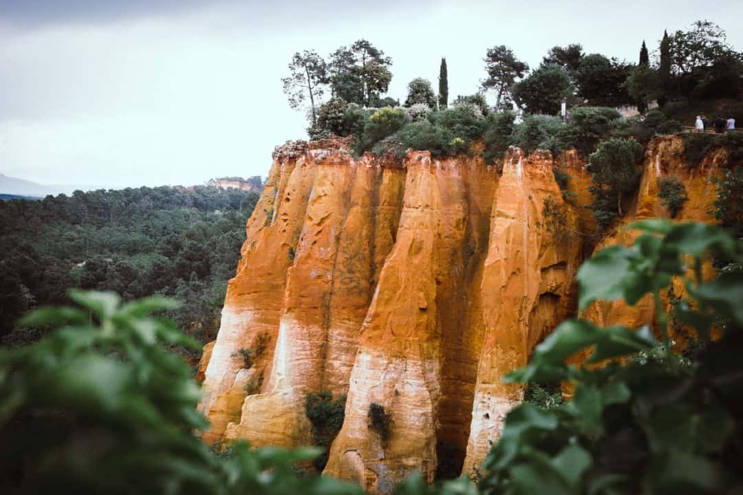
The south of France is known for many things, including its pretty beaches, but for a completely different experience head inland to Roussillon in the Luberon for a nice hike in Provence.
Roussillon, one of the most beautiful villages in the south of France, is famous for its red- and ochre-coloured houses which were painted with dye extracted from the clay of the surrounding hills. Starting and ending in the village is a short trail through these vast clay deposits known as the Sentier des Ocres or Colorado Provenzal.
There is a long trail that takes about an hour and a shorter one that takes 30 minutes, but make sure you have at least an hour to explore the village as well. The walk is family-friendly with a good path and the trail is easy to follow. However, there are 350 steps so it is not suitable for strollers or people in wheelchairs.
The trail opening hours vary by month. From May to September, it is open from 9.30 am with the last entry at 6.30. In July and August, the opening hours are slightly longer. It costs a couple of euros to enter the Sentiers des Ocres.
During summer it gets very hot so do your walking in the morning or late afternoon. At this time there will also be fewer people both in the village and on the trail. In addition, the ochre colours really stand out in the early morning or late afternoon sunshine.
You can combine a visit of Roussillon with the Lavender fields in Luberon by joining a tour like this one.
Les Gorges de l’Ardèche – Ardèche

The Gorges de l’Ardèche offers a spectacular natural escape, featuring a dramatic canyon carved by the Ardèche River. This renowned destination captivates with its towering limestone cliffs, crystal-clear waters, and abundant opportunities for adventure and exploration.
Spanning approximately 30 km (18 miles), the trail through Les Gorges de l’Ardèche can be tailored to suit various levels of experience, from short walks to more demanding day-long treks. Key highlights along the way include the Pont d’Arc, a natural stone arch that serves as a grand entrance to the gorge, and numerous vantage points offering panoramic views of the winding river and its dramatic gorges.
The path itself weaves through open cliff-top plateaus to dense forests, with plenty of spots to watch those who opted for a kayaking and canoeing trip instead. If you are looking to combine water sports and hiking, why not join a Canyoning experience like this on in Haut-Cassezac?
Lou Camin Nissart – Nice Cote d’Azur
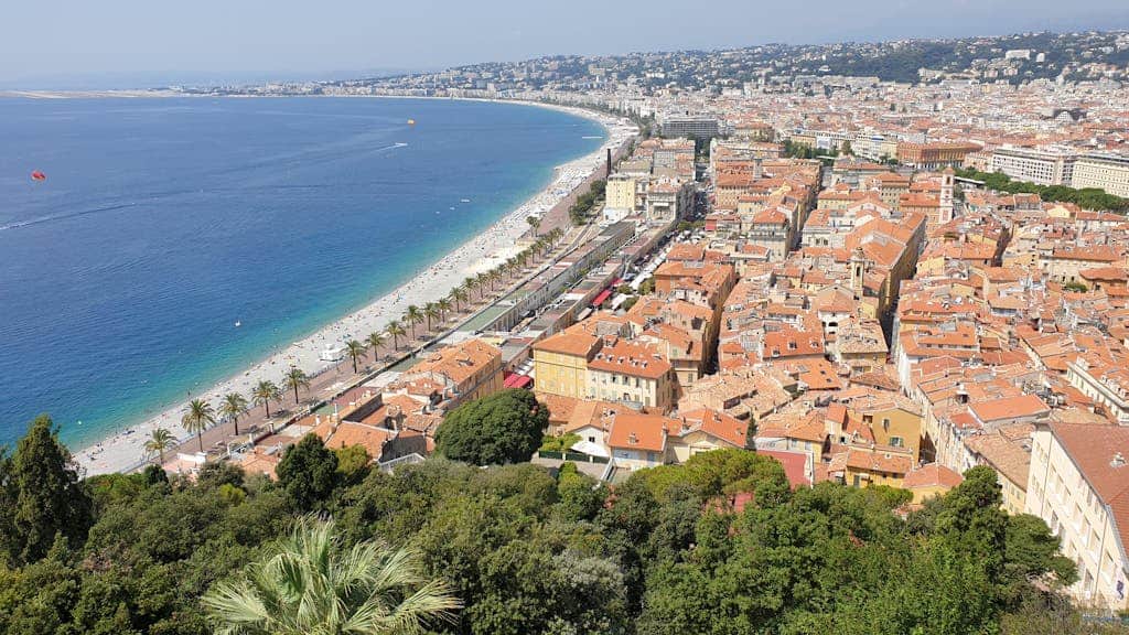
The Lou Camin Nissart hike is a scenic trail that winds through the countryside surrounding Nice. Covering over 42km (26 miles) loop trail, it’s one of the most beautiful trails in Southern France.
Hikers usually begin from Place Garibaldi near the old town and then end at the scenic Promenade des Anglais in Nice. Depending on where you are in Nice, Place Garibaldi is accessible by tram.
The trail gradually ascends into the hills and villages offering hikers panoramic views of the Mediterranean Sea and the surrounding landscapes. Because the path is well-marked it is relatively easy to follow despite the gentle slopes and occasional rocky terrain which makes it a moderate hike in terms of difficulty. It is family and dog-friendly but pets must be on leash.
Along the way, you will cross charming villages, and churches such as the Saint Roman de Bellet, and hamlets where you can take a break and immerse yourself in the local culture.
There are many various vantage points along the way where you’ll be treated to sweeping vistas of the Cote d’Azur rugged coastline.
It is usually done as a multi-day hiking trip but if you don’t have time, you can also just cover a part of the trail. Some people also bring mountain bikes with them if they want to cover the loop faster.
Sentier du Littoral – French Basque Country
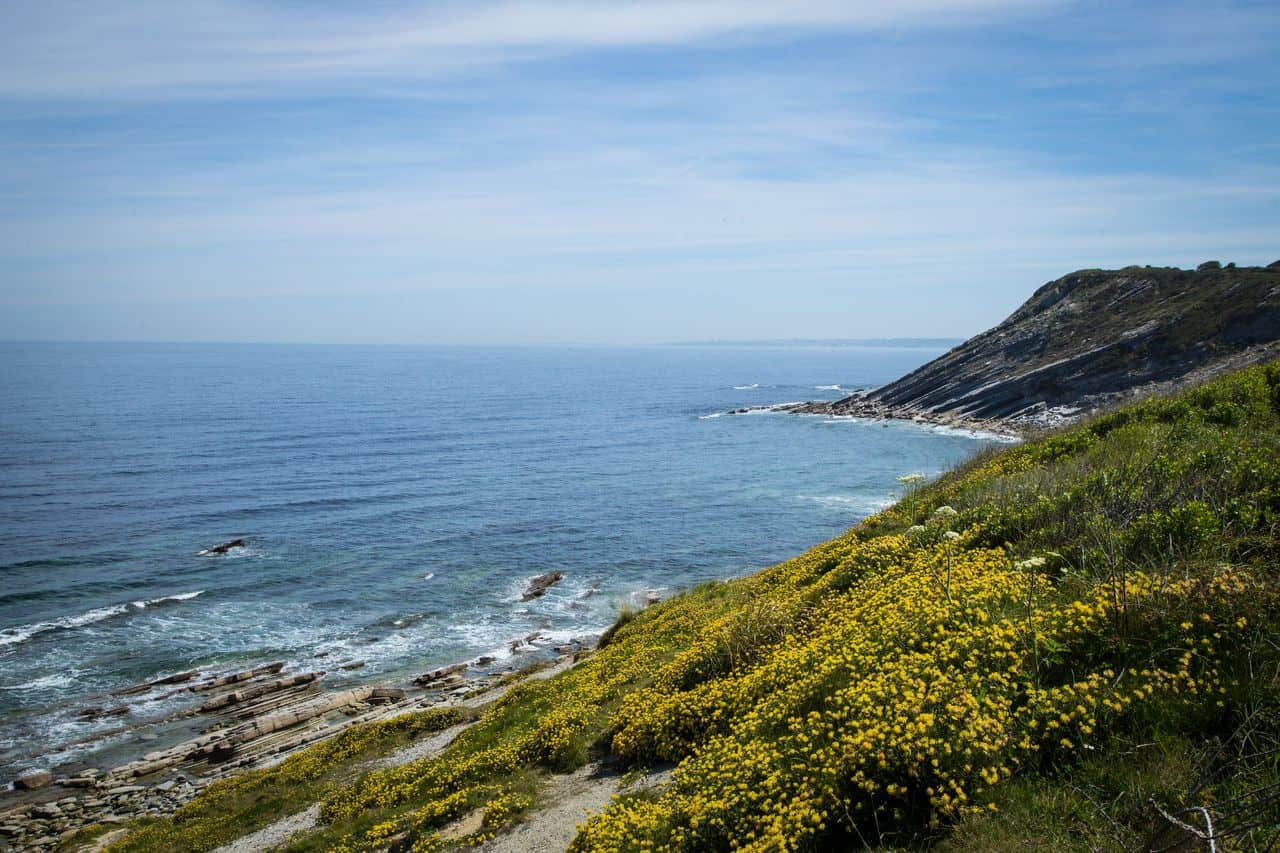
The Sentier du Littoral (Coastal Path) is a 25-kilometre Coastal Hike (15 miles) that follows the rugged and wild Basque coast from Bidart to Hendaye, passing through the town of Saint-Jean-de-Luz.
The trailhead at Bidart is a short drive (15 minutes) or train/bus ride (30 minutes) south of Biarritz, a cosmopolitan city and popular surf destination. The hike is about 5-6 hours, though it’s best to break it up over a couple of days to take long breaks at the beaches and restaurants along the way.
The French Basque coastline has some dramatic cliffs, giving excellent viewpoints from which to admire the azure ocean. The lighthouse near Saint-Jean-de-Luz is one such stand-out.
Several sandy and rocky beaches curve along the coast, and there are places to rent paddle boards or surfboards for a fun break. Many beaches have restaurants and cafes along boardwalks, too.
The hike is moderately difficult with high cliffs that can be dangerous for children. In summer, the sun is very hot and there are many extended lengths of trail without shade. No dogs, bikes, or camping allowed.
The Esterel Massif – Cote d’azur

The Esterel Massif stands out as a stunning natural wonder along the French Riviera, offering a unique hiking experience with its striking red volcanic rocks and lush greenery. This massif provides an array of trails that cater to all levels, from leisurely strolls to more challenging hikes.
A popular route within the Esterel Massif is the hike to the Pic de l’Ours, one of the highest peaks offering panoramic views of the Mediterranean Sea and the surrounding landscapes.
This hike is moderately challenging, covering around 10 km (6 miles) round trip, and takes about 4 to 5 hours to complete. The trailhead, easily accessible by car, starts at the Col de l’Ours car park, making it convenient for hikers to begin their journey along one of the best day hikes in southern France.
The well-marked path winds through the dense forest, gradually ascending towards the peak. Along the way, you will be treated to the sight of dramatic rock formations, and the gorgeous contrast between the red rocks and the azure blue of the sea which creates a breathtaking backdrop.
Spring and autumn are the best times to explore the Esterel Massif, offering mild temperatures and fewer crowds. During these seasons, the massif’s flora is in full bloom. Hikers are advised to bring plenty of water, sunscreen, and a hat, as some sections of the trail have limited shade.
Oppedette Gorge – Luberon

Oppedette Gorge, a hidden treasure in the Luberon region, offers an escape into one of Provence’s most dramatic landscapes.
This secluded canyon, carved out by the Calavon River over millennia, presents a rugged and wild beauty that captivates hikers and nature enthusiasts alike. The gorge itself, with its towering limestone cliffs and verdant flora, creates a striking contrast against the serene backdrop of the surrounding countryside.
The hike through Oppedette Gorge is both challenging and rewarding, spanning approximately 6 km (4 miles) and taking around 3 to 4 hours to complete.
Despite its remote feel, the trail is well-marked, ensuring that even those new to gorge hiking can find their way. However, the terrain can be demanding, with steep inclines and uneven ground.
The reward for this effort is a profound sense of peace and the thrill of hiking Provence’s lesser-known gems.
GR 10 – Entire French Pyrenees
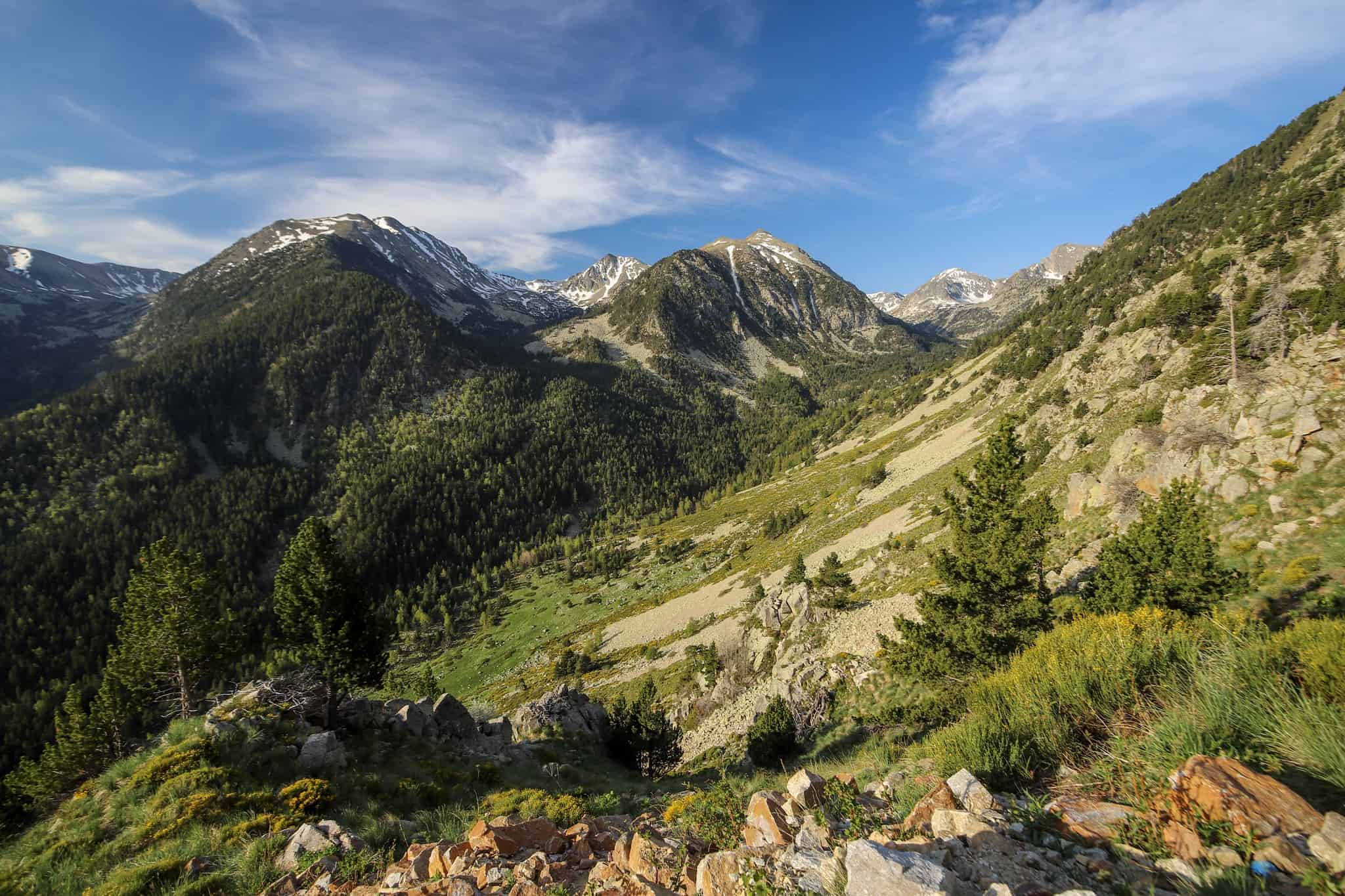
The GR 10 trail also known as the Pyrenean Way, is one of the best hiking trails in the South of France, that stretches the entire length of the French Pyrenees, from the Atlantic Ocean at Hendaye to the Mediterranean Sea at Banyuls-sur-Mer.
Spanning approximately 870 km (about 540 miles), this epic trail traverses a variety of landscapes, offering hikers an immersive experience in one of Europe’s most stunning mountain ranges.
The trail, marked by the familiar red and white stripes, will guide you over high mountain passes, alongside glistening lakes, and through charming mountain villages.
Hiking the GR 10 is a formidable challenge that typically takes around 50 days to complete in its entirety, although many choose to tackle it in sections. Each segment of the trail has its own character and challenges, ranging from moderate to strenuous, making it accessible to a wide range of hikers with varying levels of experience and time constraints.
Along the way, you will encounter a diverse array of flora and fauna, including the possibility of spotting Isards (Pyrenean chamois), marmots, and a variety of birds of prey.
That hike requires careful planning, especially regarding accommodation and logistics, as some sections are remote and require carrying supplies for multiple days, and multiple pick-up points organised ahead.
Col de la Bonette – Alpes-Maritimes
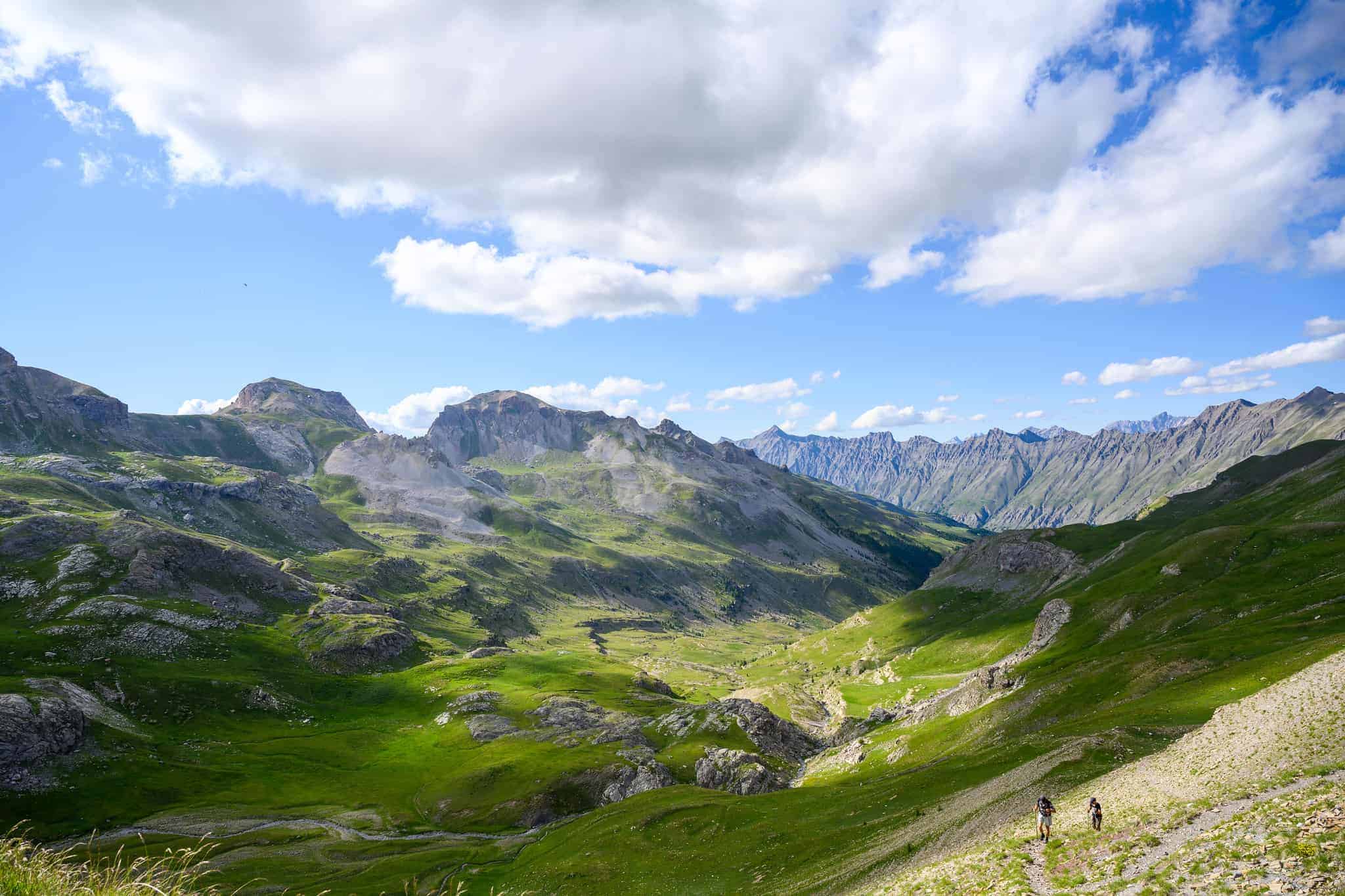
The Col de la Bonette, nestled within the Alpes-Maritimes, stands as one of Europe’s highest paved roads, circling the majestic Cime de la Bonette peak.
The ascent to the Col itself is a remarkable endeavour, offering an array of scenic vistas that capture the rugged beauty of the Alps. The trail weaves through a landscape dotted with alpine flora and fauna and panoramic views over the surrounding peaks and valleys.
Hiking in this area is particularly appealing during the summer months when the snow has receded, and the weather conditions are most favourable for outdoor activities.
The trails are well-marked, and it is advised to come prepared with appropriate gear, including sturdy boots and layers to adapt to the variable temperatures at high altitudes.
Lac d’Allos – Alpes-de-Haute-Provence

The Lac d’Allos is a stunning natural jewel nestled in the Mercantour National Park, within the Alpes-de-Haute-Provence.
It holds the title of the largest natural high-altitude lake in Europe, sitting at over 2,200 meters (7,200 feet). The lake is accessible through a moderately challenging hike, about 10 km (6 miles) round trip, offering an engaging experience through diverse alpine landscapes, with an approximate duration of 3 to 4 hours.
As you approach the lake, the breathtaking sight of its crystal-clear waters, framed by towering peaks, is a reward in itself. The Lac d’Allos is not just a destination but an experience, offering a glimpse into the stunning Mercantour one of the few national parks in the south of France.
If you are lucky and patient enough, you might spot wildlife, as the area around the lake is a habitat for marmots, chamois, and a variety of birds.
Given its altitude, the best time to visit Lac d’Allos is during the summer months when the paths are clear of snow and the weather is most amenable for hiking.
WHERE NEXT?
The South of France is fascinating. There are many things to do and see in the area. Get inspired by reading our articles about the best scenic drives or the Tops beaches. You may also be interested in these articles
- How to see white horses & bulls in Camargue
- The best Cathar Castles to visit
- Biarritz, the Queen’s beach resort
- One day in Marseille, what to do?
- 9 unique things to do in the South Est of France
- 9 unique things to do in the South West of France
- Hiking the French Basque Country
Please note │ This blog post may also include affiliate links to hostels or products we recommend, which means if you buy something following a link on this page, we’ll get a small commission. This will be of no extra cost to you but will help us continue running this blog. Thank you for your support.

About the Author
Jen is the Funder, Author & Photographer behind Talesfromthelens.comJen has lived for the past 15 years across Oceania and Ireland while also travelling in Latin America, North America, and Europe. She has visited more than 65 countries and set foot on every continent in the world! She is a coffee nerd, passionate about photography, wildlife, and outdoor activities.
For more info, check out the About page.